

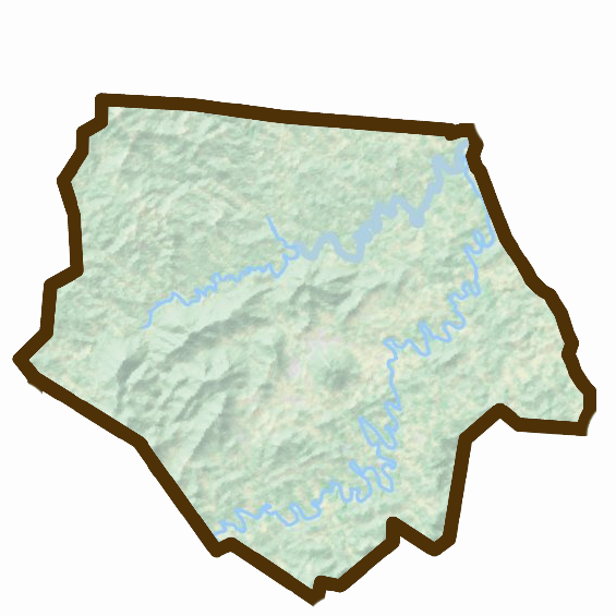
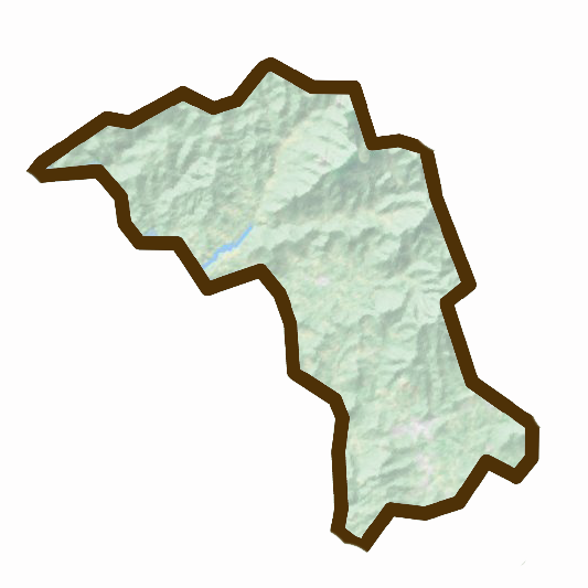
Foothills Digest is a dedicated chronicler of the vibrant life, culture, and natural beauty that flourishes in the foothills and High Country of North Carolina. Our editorial heart lies in the undulating landscapes and spirited communities that define this region, as depicted on our coverage map. This area, marked by the majestic peaks of the Blue Ridge Mountains and the rich, rolling valleys of the foothills, forms the core of our focus. While our curiosity and reporting may occasionally wander beyond these boundaries, it is the counties within this map that we consider home to our most compelling stories.
Our commitment is to provide insightful, engaging coverage that resonates with the residents and aficionados of North Carolina's foothills and High Country. From the lush, green expanses of Caldwell and Watauga to the historic textures of Burke and the vibrant tapestry of Catawba County, our coverage aims to encapsulate the essence of this region. We delve into the local culture, explore the natural wonders, celebrate the artistic and culinary achievements, and spotlight the innovations and community spirit that make this area unique.
By concentrating our efforts on this distinct geographical area, Foothills Digest ensures that our content is not only relevant but deeply rooted in the local context. We believe that the stories of this region—whether they be of traditional mountain crafts, pioneering environmental initiatives, community festivals, or groundbreaking businesses—deserve a dedicated platform. Our magazine seeks to be just that: a voice and showcase for the foothills and High Country, reflecting the diversity, resilience, and beauty of these counties.
In essence, while Foothills Digest's gaze might occasionally extend beyond, it is within the bounds of these marked counties that our heart truly lies. We are committed to telling the stories that matter to this region, contributing to the preservation and celebration of North Carolina's foothills and High Country's rich heritage and dynamic present.
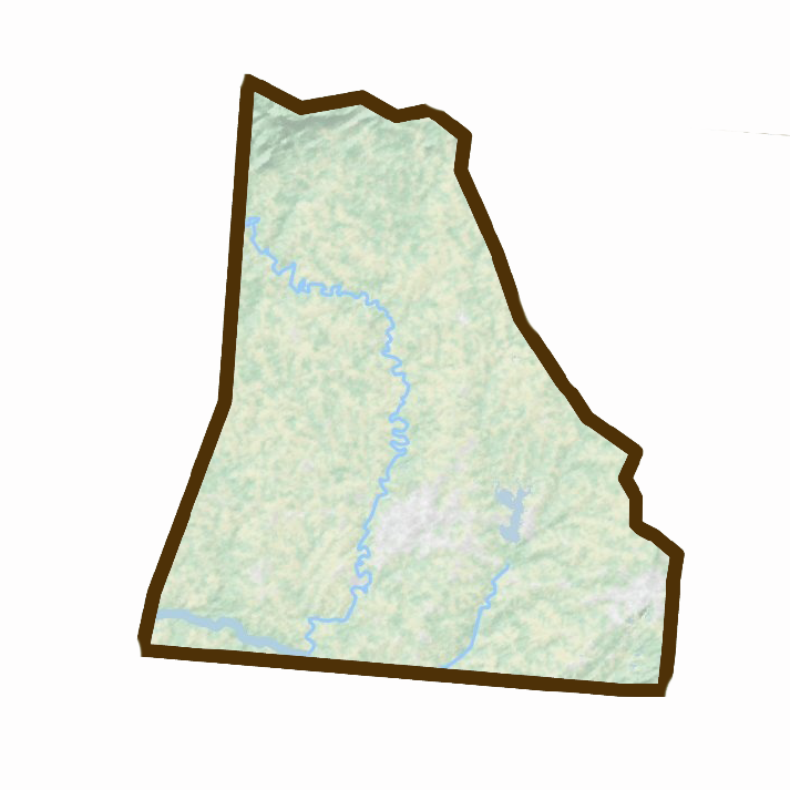
Ashe County
Ashe County, located in the U.S. state of North Carolina, has its county seat in Jefferson, which is also its largest community. The county, founded in 1799 and named in honor of Samuel Ashe, a Revolutionary patriot, Superior Court judge, and Governor of North Carolina, offers a blend of natural beauty, history, and rural charm. The landscape of Ashe County is marked by its location in the extreme northwestern part of North Carolina, bordered by Virginia and Tennessee, and situated entirely within the Appalachian Mountains region. This positioning contributes to the county's picturesque mountain scenery, making tourism a significant aspect of its economy.
Communities in Ashe County include:
- Jefferson: As the county seat, Jefferson holds a central place in Ashe County's administration and culture.
- Lansing: A town in Ashe County known for its small-town charm and community events.
- West Jefferson: Notable for its vibrant arts scene, murals, and the historic Downtown area, West Jefferson is a hub for tourists and locals alike.
In addition to these towns, Ashe County is dotted with various unincorporated communities such as Crumpler, Fleetwood, and Warrensville, each contributing to the county's rural character and charm.
Interesting Facts about Ashe County:
- Ashe County is rich in history, with evidence of Native American presence, including the Cherokee, Creek, and Shawnee tribes, as indicated by artifacts found in the region.
- The county played a role in the Revolutionary War, with a skirmish known as the Battle of Big Glades fought in July 1780.
- Ashe County was once part of the self-declared "State of Franklin," marking an interesting chapter in its early history.
- The county's geography is notable for its mountains, rolling plateaus, and the New River, one of the oldest rivers in the world, designated an "American Heritage River" in 1998 for its scenic and environmental significance.
- Ashe County has made a name for itself in agriculture, particularly in the Christmas tree industry, growing more Christmas trees than any other county in the Eastern United States as of 2014. This shift from traditional cattle farming to Christmas tree cultivation reflects the county's adaptability and the importance of agriculture to its economy.
Ashe County combines natural beauty with historical depth, offering a glimpse into the life in the Appalachian Mountains and contributing to North Carolina's diverse county landscape.
Alleghany County
Alleghany County, nestled in the U.S. state of North Carolina, is known for its scenic beauty and rich history. With its county seat in Sparta, Alleghany County stands as a testament to the Appalachian culture and landscape. Founded in 1859, the county was carved out from the eastern part of Ashe County and named for the Allegheny Mountains that grace the region. Sparta, the largest community within the county, serves as a central hub for governance and culture.
Communities in Alleghany County include:
- Sparta: As both the county seat and the largest community, Sparta is at the heart of Alleghany County, offering a blend of history, culture, and natural beauty.
The county is marked by its townships, which include Cherry Lane, Cranberry, Gap Civil, Glade Creek, Piney Creek, Prathers Creek, and Whitehead, alongside several unincorporated communities such as Ennice, Glade Valley, Laurel Springs, and Roaring Gap. Each of these areas contributes to the county's diverse landscape and community life.
Interesting Facts about Alleghany County:
- Alleghany County's history is deeply intertwined with the Native American tribes, such as the Cherokee and Shawnee, and early European settlers including English, German, and Scotch-Irish communities.
- The county experienced growth through the construction of the Blue Ridge Parkway in the 1930s, boosting tourism and leading to an increase in population and economic development.
- Alleghany County has made significant contributions to manufacturing, particularly with the establishment of D&P Pipe Works (later known as Dr. Grabow), a major tobacco pipe manufacturer, leveraging the local mountain laurel roots.
- The county's economy diversified over time, incorporating manufacturing, tourism, and the production of Christmas trees and pumpkins, with Alleghany County noted for having a substantial output of these seasonal commodities.
- Alleghany County is distinguished by its geographical features, lying entirely within the Appalachian Mountains, and is recognized for its rolling plateau, numerous hills, and significant elevation changes, contributing to its unique climate and outdoor recreational opportunities.
Alleghany County, with its rich history, cultural heritage, and natural beauty, exemplifies the spirit of the Appalachian region in North Carolina, offering residents and visitors alike a glimpse into a unique way of life shaped by its landscapes and historical currents.
Watauga County
Watauga County, positioned in the U.S. state of North Carolina, is recognized for its vibrant community and natural splendor. With Boone as its county seat and largest community, the county serves as an educational and cultural hub, largely due to the presence of Appalachian State University, which significantly influences the local demographic and economy.
Communities in Watauga County include:
- Boone: Not only the county seat but also the largest town within Watauga County, Boone is home to Appalachian State University, contributing to its status as a lively educational and cultural center.
- Beech Mountain: Known for its recreational activities and status as one of the highest towns in the Eastern United States.
- Blowing Rock: A town famous for its scenic views, unique rock formations, and as a destination for tourists seeking natural beauty.
- Seven Devils: A community known for its outdoor activities, including skiing and hiking.
In addition to these towns, Watauga County features unincorporated communities like Deep Gap, Foscoe, and Valle Crucis, each offering unique contributions to the county's character and lifestyle.
Interesting Facts about Watauga County:
- The county was established in 1849 from portions of Ashe, Caldwell, Wilkes, and Yancey counties, named after the Watauga River, with various interpretations of its name suggesting "beautiful water," among other meanings.
- It is renowned for its exceptionally mountainous terrain within the Appalachian Mountains range, contributing to its nickname as the "High Country."
- Watauga County's highest point is Calloway Peak on Grandfather Mountain, reaching 5,964 feet above sea level, highlighting the county's dramatic landscape.
- Boone, the county seat, stands out not only for its educational institutions but also for its elevation, making it the highest city of its size east of the Mississippi River.
- The county's geography and elevation result in a humid continental climate, offering cooler temperatures and more pronounced seasonal changes compared to other regions of North Carolina.
Watauga County encapsulates the essence of the Appalachian region with its rich cultural history, educational importance, and natural beauty, making it a unique and cherished part of North Carolina.
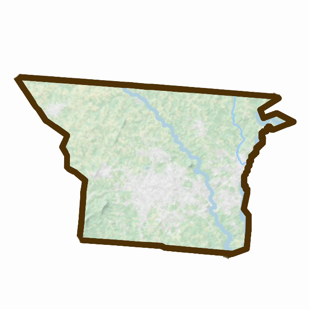
Wilkes County

Wilkes County, nestled in North Carolina's picturesque western mountain region, boasts a rich tapestry of history, culture, and natural beauty. As of the 2020 census, it had a population of 65,969, with Wilkesboro serving as the county seat and North Wilkesboro as its largest community. This county forms part of the North Wilkesboro, NC Micropolitan Statistical Area.
Key Communities within Wilkes County:
- Wilkesboro: The county seat, known for its historical significance and as a center of government and commerce.
- North Wilkesboro: The largest community in Wilkes County, famous for its racing history and vibrant local economy.
Wilkes County has a storied past that intertwines with the fabric of American history, from its founding in 1778 through parts of Surry County and the Washington District. Named after John Wilkes, an English political radical who championed the cause of American independence, the county has a legacy of resilience and patriotism.
Interesting Aspects of Wilkes County:
- Historical Significance: The county's origins are deeply rooted in the American Revolutionary period, reflecting the spirit of independence and self-determination that characterizes its community.
- Moonshine and NASCAR: Wilkes County's history as the "Moonshine Capital of the World" and a birthplace of stock-car racing is a testament to its unique cultural heritage. The North Wilkesboro Speedway, the first NASCAR track, underscores the county's pivotal role in the development of this popular sport.
- Geography and Natural Beauty: Spanning the eastern slope of the Blue Ridge Mountains, Wilkes County offers a diverse landscape, from mountainous terrains to the rolling hills of the Piedmont. This geographical diversity provides a backdrop for numerous outdoor activities and contributes to the county's scenic charm.
- Cultural and Recreational Opportunities: With Stone Mountain State Park and the W. Kerr Scott Reservoir, the county is a haven for outdoor enthusiasts, offering activities such as hiking, fishing, and boating.
Wilkes County represents a harmonious blend of history, culture, and natural beauty, making it a noteworthy part of North Carolina's western mountain region. Its contributions to the American story, particularly in the realms of moonshining and NASCAR, add a unique flavor to the county's identity.
Avery County

Avery County, nestled in the heart of North Carolina, stands as the state's youngest county, established in 1911. Its creation was the culmination of efforts from parts of Caldwell, Mitchell, and Watauga Counties. Named in honor of Waightstill Avery, a colonel in the American Revolutionary War and North Carolina's first Attorney General, Avery County has grown into a vibrant community with a population of 17,806 as of the 2020 census. The county seat, Newland, is distinguished as the highest county seat in the Eastern United States, reflecting the county's mountainous terrain and rich natural beauty.
Communities within Avery County:
- Newland: The county seat, Newland is central to Avery County's governance and administrative services.
- Banner Elk: Recognized as the largest community in Avery County, Banner Elk is known for its scenic vistas and outdoor recreational activities.
Interesting Facts about Avery County:
- Cultural and Historical Richness: Avery County's history as the 100th and final county formed in North Carolina adds a unique chapter to the state's rich tapestry. Its naming after a Revolutionary War figure underscores the deep historical roots and patriotic spirit that permeates the area.
- Natural Beauty and Recreation: The county's landscape is dominated by the Appalachian Mountains, offering breathtaking scenery and abundant outdoor activities. Avery County is home to the highest point, Grassy Ridge Bald, and is renowned for landmarks like Grandfather Mountain. Its terrain makes it a haven for hikers, nature enthusiasts, and those seeking the tranquility of mountain life.
- Economic Contributions: Avery County has carved out a niche for itself in the production of Christmas trees, significantly contributing to the state and national markets. This agricultural focus highlights the county's commitment to sustaining and promoting its natural resources and local economy.
Avery County embodies the essence of mountain living in North Carolina, blending historical significance, natural splendor, and community spirit. Its elevation as both the youngest county and the site of the highest county seat in the East speaks to its unique place within the state's diverse landscape.
Caldwell County

Caldwell County, situated in the scenic foothills of the Blue Ridge Mountains in North Carolina, is a county rich in natural beauty and history. As of the 2020 census, it has a population of 80,652, with Lenoir serving as its county seat. Established in 1841 from parts of Burke County and Wilkes County, it was named in honor of Joseph Caldwell, the first president of the University of North Carolina at Chapel Hill. Caldwell County is part of the Hickory-Lenoir-Morganton, NC Metropolitan Statistical Area, offering a blend of cultural heritage and natural attractions.
Communities within Caldwell County:
- Lenoir: As the county seat, Lenoir is central to the county's administration and culture. It is known for its historical significance and as a hub for arts and music.
- Blowing Rock: A part of Blowing Rock is within Caldwell County, known for its picturesque views and as a popular destination for tourists seeking outdoor activities and natural beauty.
Interesting Facts about Caldwell County:
- Geographic Diversity: The county features a diverse landscape, from the majestic Blue Ridge Mountains to the serene Brushy Mountains and the rolling Piedmont. This diversity offers a range of outdoor activities, including hiking, fishing, and scenic drives.
- Cultural Heritage: Caldwell County has a rich heritage of music, crafts, and art, influenced by its Appalachian roots. The county is home to traditional musicians and artists, showcasing the area's cultural depth.
- Economic Development: Over the years, Caldwell County has evolved from its traditional industries to embrace manufacturing, healthcare, and tourism, contributing to its economic growth and community development.
Caldwell County embodies the essence of North Carolina's mountain and Piedmont regions, offering a unique mix of natural beauty, historical significance, and vibrant community life. Its geographic diversity and cultural heritage make it a noteworthy part of the state's landscape.
Alexander County
Alexander County, nestled in the state of North Carolina, was established in 1847. Its formation came from parts of what were then Iredell County, Caldwell County, and Wilkes County. The county was named in honor of William Julius Alexander, a notable figure who served as a Speaker of the North Carolina House of Commons. As of the 2020 census, Alexander County had a population of 36,444, with its county seat located in Taylorsville. The largest community within the county is Bethlehem. Alexander County is part of the Hickory-Lenoir-Morganton, NC Metropolitan Statistical Area, highlighting its connectivity and influence within the broader region.
Communities within Alexander County:
- Taylorsville: Serving as the county seat, Taylorsville is central to Alexander County's governance and community activities.
- Bethlehem: Recognized as the largest community within the county, Bethlehem contributes significantly to the county's character and demographic profile.
Interesting Facts about Alexander County:
- Cultural and Historical Significance: Alexander County's naming honors a historical figure associated with North Carolina's governance, linking the county to the state's rich political heritage.
- Geographic Features: The county is distinguished by its location within the Foothills region of western North Carolina. The presence of the Brushy Mountains and its varied terrain offer residents and visitors alike a unique blend of natural beauty and outdoor recreational opportunities.
- Economic and Social Development: Alexander County has evolved to balance its agricultural roots with modern economic developments, including manufacturing and services, contributing to the overall growth and stability of the region.
Alexander County embodies a mix of historical significance, natural beauty, and community-oriented living. Its establishment and development reflect the dynamic changes and ongoing progress within North Carolina, making it a notable part of the state's diverse county landscape.
Iredell County
Iredell County, situated in North Carolina, boasts a population of 186,693 as per the 2020 census, making it a significant contributor to the Charlotte-Concord-Gastonia, NC-SC Metropolitan Statistical Area. The county seat is Statesville, while Mooresville stands as its largest community. Founded in 1788 from a portion of Rowan County, Iredell County was named in honor of James Iredell, a prominent figure who was one of the first justices of the Supreme Court. The county motto, "Crossroads for the Future," reflects its pivotal role in the region, both historically and in modern times.
Communities within Iredell County:
- Statesville: The county seat, known for its rich history and as a hub for business and culture within the county.
- Mooresville: Recognized as the largest community in Iredell County, Mooresville is often referred to as "Race City USA" due to its significant contributions to auto racing.
Interesting Facts about Iredell County:
- Historical Significance: Iredell County's formation and naming commemorate a key figure in America's judicial and political history, tying the county to the broader narrative of the United States' formation.
- Economic and Cultural Hub: As part of the Charlotte-Concord-Gastonia, NC-SC Metropolitan Statistical Area, Iredell County plays a critical role in the economic and cultural activities of the region, including its notable impact on the NASCAR and auto racing industries.
- Geographic Diversity: The county features a diverse landscape, from the Brushy Mountains in the northwestern section to the rolling hills and river valleys that characterize much of its terrain. Lake Norman, North Carolina's largest manmade lake, is a key geographic feature of southern Iredell County, offering recreational activities and contributing to the county's appeal.
Iredell County combines historical depth with modern vibrancy, offering residents and visitors a rich tapestry of experiences, from its involvement in early American history to its status as a contemporary cultural and economic center.
Yancey County
Yancey County, located in North Carolina, boasts a population of 18,470 as of the 2020 census, with Burnsville serving as both its county seat and largest community. Established in December 1833 from parts of Burke and Buncombe counties, the county is named in honor of Bartlett Yancey, a figure renowned for his roles as a U.S. Congressman and speaker of the N.C. Senate, where he advocated for educational initiatives and fair representation in the General Assembly. Mount Mitchell, the highest peak in the Eastern U.S. at 6,684 feet, lies within Yancey County's boundaries, highlighting the county's distinctive topographical character and its inclusion of part of the majestic Black Mountains.
Communities within Yancey County:
- Burnsville: The county seat and largest community, Burnsville is central to the county's administration, culture, and heritage. It is named in honor of Captain Otway Burns, a War of 1812 naval hero and advocate for the county's establishment.
Interesting Facts about Yancey County:
- Historical and Cultural Heritage: Yancey County's establishment reflects a commitment to education and representation, values embodied by Bartlett Yancey. The presence of Scottish, English, Scotch-Irish, and Irish settlers in the 18th century underscores the county's rich cultural tapestry.
- Natural Beauty and Geographic Significance: Dominated by Mount Mitchell and part of the Black Mountains, Yancey County offers some of the most stunning landscapes in the Eastern U.S., making it a haven for outdoor enthusiasts and nature lovers.
- Monuments and Landmarks: The county's reverence for its history is evident in the statue of Captain Otway Burns in Burnsville, symbolizing the area's connection to naval heroism and legislative advocacy for western North Carolina.
Yancey County represents a unique blend of natural beauty, historical depth, and community pride. Its landscapes offer not just outdoor adventures but also a tangible connection to the early settlers' experiences and the visionary leaders who contributed to the county's founding.
Mitchell County
Mitchell County, nestled in North Carolina, had a population of 14,903 as recorded in the 2020 census. Bakersville serves as the county seat, while Spruce Pine is recognized as the largest community. Mitchell County, established in 1861, was named in honor of Elisha Mitchell, a distinguished professor at the University of North Carolina. Professor Mitchell was the first to assert that a peak in the Black Mountains, now known as Mount Mitchell, was the highest point east of the Mississippi River.
Communities within Mitchell County:
- Bakersville: The county seat, known for its vibrant arts community and as the "Gateway to Roan Mountain."
- Spruce Pine: The largest community, famously nicknamed the "Mineral City of the World" due to its rich mineral resources.
Interesting Facts about Mitchell County:
- Historical Significance: The county's history is deeply intertwined with the legacy of Elisha Mitchell, reflecting the region's rich educational and scientific heritage.
- Geographical Features: The county is home to Spruce Pine, nicknamed the "Mineral City of the World".
- Cultural and Natural Attractions: The area is celebrated for its natural beauty and hosts several festivals, including the North Carolina Mineral and Gem Festival and the North Carolina Rhododendron Festival. These events draw visitors from across the region to explore the county's natural and cultural resources.
Mitchell County's blend of historical depth, natural beauty, and cultural richness makes it a unique and compelling part of North Carolina. The county's commitment to preserving its heritage while promoting its natural assets offers a window into the Appalachian region's past, present, and future.
McDowell County
McDowell County, nestled next to the Blue Ridge Mountains in Western North Carolina, had a population of 44,578 as of the 2020 census. The county seat, Marion, also stands as its largest community. McDowell County is part of the Marion, NC Micropolitan Statistical Area, which is further included in the Charlotte-Concord, NC Combined Statistical Area.
Communities within McDowell County:
- Marion: The county seat and largest community in McDowell County, Marion is known for its historical significance and as a gateway to the beautiful landscapes of Western North Carolina.
- Old Fort: Another significant town in McDowell County, known for its historical importance and scenic beauty.
Interesting Facts about McDowell County:
- Historical Significance: Archaeological findings have shown that the earliest inhabitants of McDowell County lived there from the Woodland period and Mississippian culture era, from 250 to 1500 AD. The county has also seen the passage of Spanish explorer Juan Pardo in 1566, aiming to establish forts and seeking precious metals.
- Cultural Heritage: The county is named after Joseph McDowell, a Revolutionary War leader and hero of the Battle of King's Mountain, emphasizing its rich historical roots in the formation of the United States.
- Natural Beauty and Geographical Features: McDowell County is home to parts of the Blue Ridge Parkway and the Pisgah National Forest, offering stunning landscapes, numerous waterfalls including Catawba Falls and Toms Creek Falls, and the unique Linville Caverns. The county's geography reflects the diverse Appalachian environment, from rolling hills to towering peaks like Pinnacle, providing abundant opportunities for outdoor activities and nature exploration.
McDowell County embodies a blend of historical depth, natural beauty, and cultural richness, making it a notable part of North Carolina's diverse landscape. Its historical sites, scenic parks, and commitment to preserving natural and cultural heritage contribute to its identity as a vibrant community nestled in the Appalachian region.
Burke County
Burke County, located in North Carolina, had a population of 87,570 as of the 2020 census. The county seat is Morganton, which is also the largest community within the county. Burke County is part of the Hickory-Lenoir-Morganton, NC Metropolitan Statistical Area.
Communities within Burke County:
- Morganton: As both the county seat and largest community, Morganton is central to the administrative and cultural life of Burke County.
Interesting Facts about Burke County:
- Historical Significance: Burke County, formed in 1777 from Rowan County, is named after Thomas Burke, a delegate to the Continental Congress and later governor of North Carolina. The county's history is rich, with Native American settlements predating European exploration and the presence of Spanish explorer Juan Pardo in 1567, who built Fort San Juan, marking an early European claim in the interior of what is now the United States.
- Geographical Features: The county is known for its natural beauty, including parts of two lakes (Lake James and Lake Rhodhiss), Table Rock, and Linville Gorge Wilderness within Pisgah National Forest. It offers a variety of outdoor activities and scenic vistas.
- Cultural Heritage and Natural Attractions: Burke County has a legacy of being at the crossroads of early American and pre-colonial history, evident in archaeological finds and historical sites. The county also hosts parts of the Blue Ridge Parkway, providing access to breathtaking landscapes and recreational opportunities.
Burke County's blend of historical depth, cultural richness, and natural beauty makes it a significant part of North Carolina's diverse landscape. Its historical sites, scenic parks, and commitment to preserving its rich heritage contribute to its identity as a vibrant community nestled within the Appalachian region.
Catawba County
Catawba County, located in the U.S. state of North Carolina, had a population of 160,610 as of the 2020 census. The county seat is Newton, and its largest community is Hickory. Catawba County is part of the Hickory-Lenoir-Morganton, NC Metropolitan Statistical Area.
Communities within Catawba County:
- Newton: The county seat, known for its historical significance and vibrant downtown area.
- Hickory: The largest community in Catawba County, Hickory is a center for manufacturing, retail, and a variety of cultural and recreational activities.
Interesting Facts about Catawba County:
- Historical Significance: Established in 1842 from Lincoln County, Catawba County is named after the Catawba River. The name "Catawba" is believed to originate from the Choctaw language, translating loosely to "to divide or separate, to break." The county has a rich history that includes the Catawba people, one of the most powerful Southeastern Siouan-speaking tribes in the Carolina Piedmont.
- Geography: Catawba County boasts a total area of 416.02 square miles, with 401.37 square miles being land and 14.65 square miles being water. It is home to several major water bodies, including Lake Hickory and Lake Norman, making it a hub for water-related activities and natural beauty.
- Cultural and Natural Attractions: Catawba County's historical sites, such as the Murray's Mill Historic Site and the Old Hickory Tavern, contribute to its rich cultural heritage. The county is also known for its involvement in manufacturing and technology, housing the Apple iCloud data center in Maiden and being part of the "North Carolina Data Center Corridor."
Catawba County combines historical depth, technological advancement, and natural beauty, making it a vibrant community with a rich cultural heritage and a forward-looking perspective on development and innovation.
Rutherford County

Rutherford County, located in the southwestern area of North Carolina, had a population of 64,444 as of the 2020 census. The county seat is Rutherfordton, and its largest community is Forest City. The county forms part of the Forest City, NC Micropolitan Statistical Area.
Communities within Rutherford County:
- Rutherfordton: The county seat, known for its historical significance and as the center of governance.
- Forest City: The largest community within Rutherford County, known for its vibrant economy and cultural activities.
Interesting Facts about Rutherford County:
- Historical Background: Initially inhabited by the Cherokee, the area was part of Mecklenburg County before becoming a separate entity in 1779. It was named after Griffith Rutherford, a general in the American Revolutionary War and a leader of an expedition against the Cherokee in 1776.
- Gold Production: Rutherford County was a significant gold-producing region in America from the late 18th century until the California gold rush of the 1840s. The first gold dollars in the United States were produced by Christopher Bechtler and his sons, German goldsmiths who set up a mint near Rutherfordton.
- Geographical Features: The county spans an area of 567.25 square miles, with 565.44 square miles being land and 1.81 square miles being water. It is known for its diverse mineral resources, including gold, platinum, and rare-earth elements like samarskite, contributing to its historical and economic significance.
- Cultural and Natural Attractions: Rutherford County features several state and local protected areas, including the Bechtler Mint Site Historic Park and parts of Chimney Rock State Park and South Mountains State Park. These sites offer opportunities for outdoor activities and learning about the county's rich history.
Rutherford County's blend of historical significance, cultural richness, and natural beauty makes it a noteworthy part of North Carolina's diverse landscape. Its historical sites, scenic parks, and commitment to preserving its heritage contribute to its identity as a vibrant community within the Appalachian region.
Cleveland County
Cleveland County, situated in the foothills of the Blue Ridge Mountains and the western Piedmont of North Carolina, had a population of 99,519 as of the 2020 census. The county seat and largest community is Shelby. Cleveland County is part of the Shelby-Kings Mountain, NC Micropolitan Statistical Area, which also falls within the broader Charlotte-Concord, NC-SC Combined Statistical Area.
Communities within Cleveland County:
- Shelby: The county seat and largest community in Cleveland County, Shelby is known for its rich historical significance and vibrant cultural life.
Interesting Facts about Cleveland County:
- Historical Significance: Cleveland County was formed in 1841 from parts of Lincoln and Rutherford counties and named after Benjamin Cleveland, a hero of the American Revolutionary War known for his participation in the Battle of Kings Mountain. The spelling of the county's name was changed from "Cleaveland" to its current form in 1887.
- Geographical Features: The county features a varied landscape that includes parts of the South Mountains and the distinct peaks of Crowders Mountain and Kings Mountain. The area's geography offers a mix of hilly and mountainous terrain, providing scenic beauty and outdoor recreational opportunities.
- Cultural and Natural Attractions: Cleveland County boasts various state and local protected areas, such as the Broad River Greenway and Kings Mountain Gateway Trail. The county's commitment to preserving natural spaces and promoting outdoor activities reflects its dedication to the well-being of its residents and visitors.
Cleveland County combines historical depth, geographical diversity, and cultural richness, making it a notable part of North Carolina's diverse landscape. Its historical roots, scenic natural areas, and vibrant community life contribute to its unique identity within the state.
Lincoln County

Lincoln County, located in North Carolina, had a population of 86,810 as of the 2020 census, making it the most populous "Lincoln County" in the United States. The county seat is Lincolnton. It is part of the Charlotte-Concord-Gastonia, NC-SC Metropolitan Statistical Area.
Communities within Lincoln County:
- Lincolnton: The county seat and largest community, Lincolnton is central to the county's governance, culture, and services.
Interesting Facts about Lincoln County:
- Historical Background: Lincoln County was formed in 1779 from the eastern part of Tryon County. It was named after Benjamin Lincoln, a general in the American Revolutionary War. The county has a rich history, including the Battle of Ramsour's Mill, a significant event during the American Revolution that took place near Lincolnton.
- Geographical Features: The county spans an area of 304.87 square miles, with 295.85 square miles being land and 9.02 square miles being water. Lincoln County's landscape includes a portion of the South Mountains, providing a scenic backdrop and opportunities for outdoor activities.
- Cultural and Natural Attractions: Lincoln County offers various state and local protected areas such as the Mountain Island Educational State Forest and Rock Springs Nature Preserve. The county's parks and natural sites offer residents and visitors alike a chance to engage with the area's natural beauty and recreational activities.
Lincoln County combines historical depth, natural beauty, and a strong sense of community, making it a significant part of North Carolina's diverse landscape. Its commitment to preserving its rich heritage while promoting growth and development contributes to its unique identity within the state.
Gaston County
Gaston County, located in North Carolina, had a population of 227,943 as of the 2020 census, making it a significant area within the Charlotte-Concord-Gastonia, NC-SC Metropolitan Statistical Area. The county seat is Gastonia, which is also its largest community. Gaston County, founded in 1846, was named in honor of William Gaston, a member of the United States Congress and the North Carolina Supreme Court.
Communities within Gaston County:
- Gastonia: The county seat and largest city in Gaston County, known for its historical significance and vibrant community life.
Interesting Facts about Gaston County:
- Historical Background: Gaston County's early European settlers were predominantly Scots Irish, Pennsylvania Dutch, and English. The county has a rich history of early fortification, such as a fort built at the Point at the junction of the Catawba and South Fork Rivers in the 1750s, due to hostilities with the Cherokee.
- Geographical Features: The county spans 363.68 square miles, with most of the area being land. It is characterized by its location in the southern Piedmont region, with a landscape that includes the Catawba River and King's Pinnacle, the highest point in the county.
- Cultural and Natural Attractions: Gaston County is home to several state and local protected areas, including Crowders Mountain State Park and Daniel Stowe Botanical Garden, highlighting the county's commitment to preserving natural beauty and offering recreational activities.
Gaston County combines a rich historical heritage with natural beauty and a strong sense of community, making it an integral part of North Carolina's landscape. Its contribution to the broader Charlotte metropolitan area enhances its significance in terms of economic, cultural, and social development.
Our Region
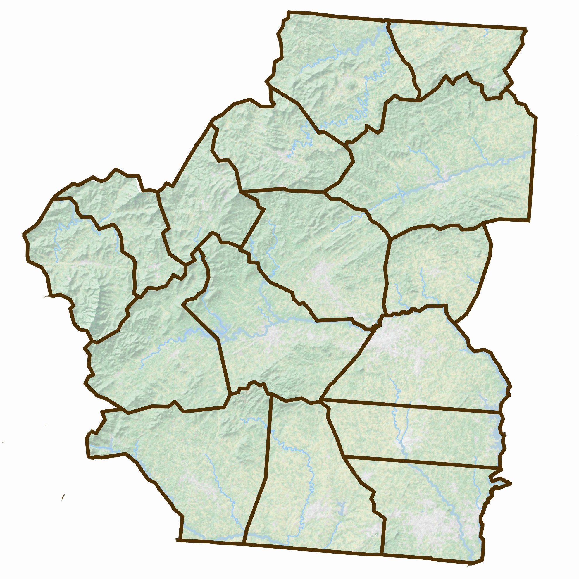
The counties of North Carolina, each with their unique history, culture, and geography, collectively contribute to the rich tapestry that defines the state. From the mountainous terrains of Ashe, Alleghany, and Watauga Counties to the Piedmont regions of Gaston, Lincoln, and Cleveland Counties, North Carolina boasts a diverse landscape that caters to a wide array of outdoor activities, historical exploration, and community engagement.
Ashe County, renowned for its Christmas tree farms, and Alleghany County, known for its scenic beauty and outdoor recreation, highlight the natural splendor of North Carolina's Appalachian region. Watauga County, with Boone as a cultural hub, emphasizes the state's appeal to tourists and residents alike who seek a blend of natural beauty and vibrant community life.
Further south, counties like Gaston, Lincoln, and Cleveland serve as key components of the Charlotte-Concord-Gastonia, NC-SC Metropolitan Statistical Area, driving economic growth and fostering strong communities. Gaston County's rich industrial history and present-day natural attractions like Crowders Mountain, Lincoln County's historical sites and connection to the American Revolutionary War, and Cleveland County's industrial boom and natural beauty exemplify the dynamic history and continuous development of North Carolina's Piedmont.
These counties, each with their distinct identity, contribute to North Carolina's allure, from the high peaks and lush forests of the Appalachians to the rolling hills and vibrant towns of the Piedmont. The state's diverse geography not only offers a plethora of recreational opportunities but also tells the story of a region shaped by its natural landscape, historical events, and the communities that call it home. Whether it's exploring the historical battlegrounds, enjoying the natural parks, or engaging in the local cultures and economies, North Carolina's counties collectively showcase the state's rich heritage and promising future